Agricultural Drone Filming for Modern Farming and Sustainability
In recent years, drones have moved far beyond cinematic landscapes and real estate flyovers. Today, agricultural drone footage plays a critical role in how farms operate, how ecosystems are studied, and how sustainability initiatives are communicated. From precision farming to large-scale environmental assessments, aerial technology has become an essential visual and analytical tool across industries.
Drone footage offers a unique combination of accuracy, scale, and efficiency. It provides data-rich visuals that support decision-making while also creating compelling content for reporting, funding proposals, and public communication.
As the demand for smarter land management and transparent environmental monitoring grows, so does the importance of professional drone filming for agriculture and environmental research.
The Evolution of Agricultural Drone Footage
The early use of drones in agriculture focused largely on basic aerial photography. Farmers and land managers used simple flyovers to gain a better overview of fields that were otherwise difficult to assess from the ground. Over time, drone technology has evolved rapidly, bringing higher-resolution cameras, stabilised video, longer flight times, and advanced sensor integrations.
Modern drone filming for agriculture now supports complex tasks. What once required satellite imagery or time-consuming manual surveys can now be achieved quickly with precise, low-altitude flights that capture detailed visual data. This shift has transformed drones into practical farming tools rather than experimental gadgets.
At the same time, professional video production standards have raised expectations. Agricultural drone footage is no longer just about data collection; it is also about clear visual storytelling. Whether documenting seasonal changes, demonstrating farming innovation, or supporting regulatory compliance, high-quality aerial footage helps translate complex information into visuals that are easy to understand and act upon.
Precision Farming and the Role of Drone Videography
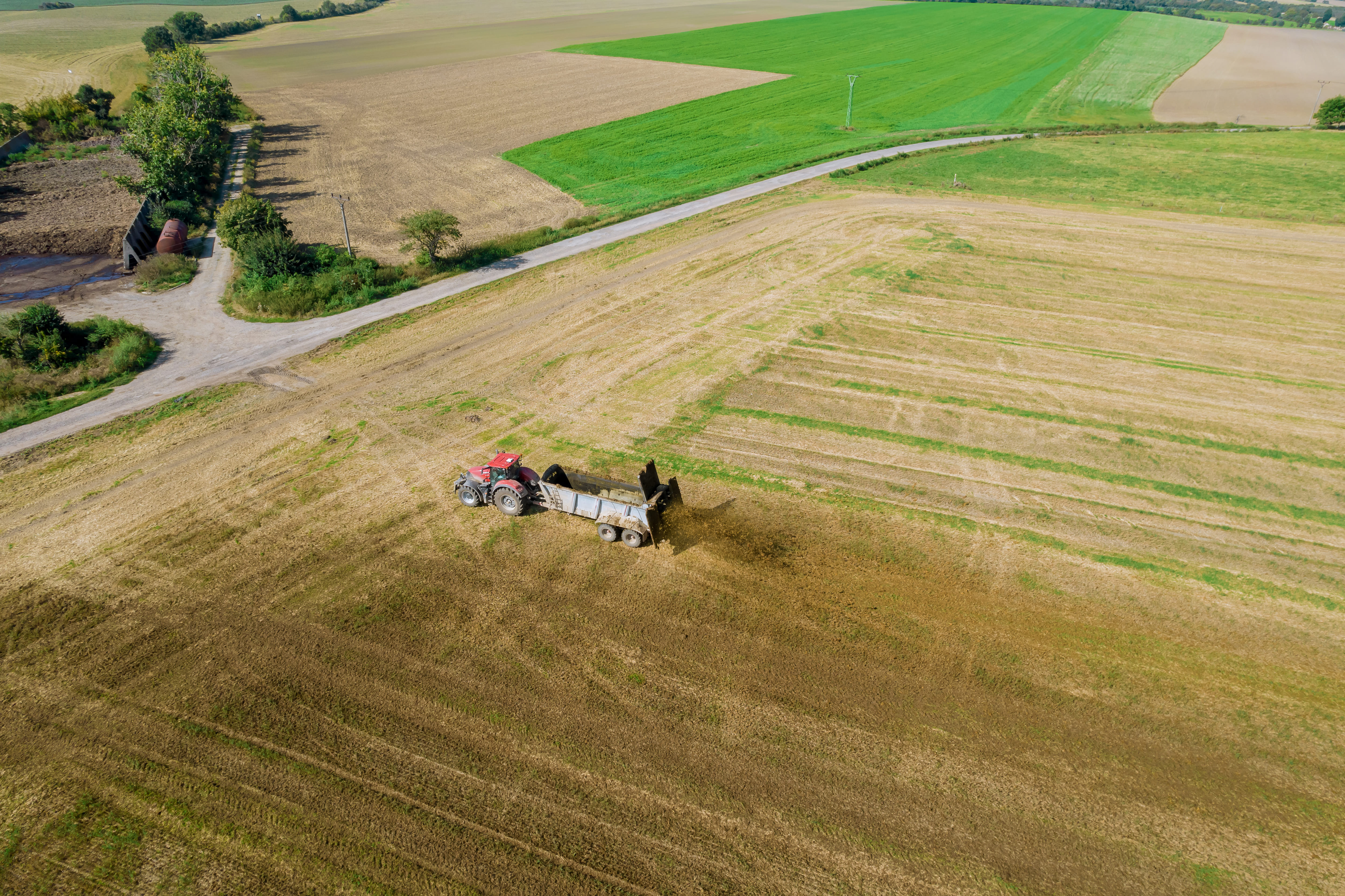
Precision farming drone video provides farmers and agribusinesses with a comprehensive view of their land, enabling them to detect issues early and respond efficiently.
Unlike ground-level inspections, drone surveys capture patterns across entire fields, allowing decision-makers to prioritise interventions and allocate resources more effectively. This approach reduces waste, lowers costs, and improves overall yield quality.
Beyond operational benefits, drone videography also plays a communication role. Agricultural companies increasingly use aerial visuals to demonstrate best practices to partners, investors, and regulators. A well-produced farming drone video can showcase sustainable land use, modern equipment, and responsible crop management in a way that static reports simply cannot.
Environmental Drone Videography for Research and Conservation
While agriculture has embraced drone technology for efficiency, environmental science has adopted it for precision and scale. Environmental drone videography allows researchers to observe ecosystems without disturbing them, capturing data that would be difficult or dangerous to collect on foot.
From wetlands and forests to coastlines and protected reserves, drones provide a bird’s-eye view of environmental change. Researchers use eco research drone video to monitor deforestation, track erosion, study wildlife habitats, and assess the impact of climate-related events. The ability to repeat flights over time makes drone footage particularly valuable for longitudinal studies and impact assessments.
Visual evidence strengthens grant applications, policy recommendations, and public awareness campaigns. When sustainability teams can clearly show the state of an ecosystem and how it is changing, their message carries greater credibility and urgency.
Aerial Survey Footage for Large-Scale Land Assessments
Large-scale land assessments have traditionally been resource-intensive, requiring teams on the ground and lengthy data processing.
Government bodies and environmental agencies rely on drone surveys to assess land use, plan infrastructure projects, and evaluate environmental risks. High-resolution aerial footage supports mapping, volumetric analysis, and terrain modelling, helping stakeholders make informed decisions based on real-world conditions rather than estimates.
In agricultural contexts, aerial surveys support land planning and compliance monitoring. Drone footage can document boundary conditions, drainage systems, and land restoration efforts, providing verifiable records that meet regulatory standards.
When captured professionally, this footage also doubles as visual content for stakeholder reporting and public communications.
Farming Drone Services as a Commercial Asset
The growing adoption of farming drone services reflects a broader shift toward data-driven agriculture. Professional drone filming delivers value not only through insights but also through its role in branding and business development.
For agritech companies and service providers, drone footage supports product demonstrations and case studies. Showing how technology performs in real field conditions builds confidence and accelerates adoption.
In this sense, drone videography becomes both an operational tool and a strategic marketing asset.
Sustainability Drone Content for Impact and Reporting
Sustainability initiatives depend on credible measurement and clear communication. Sustainability drone content bridges this gap by combining factual documentation with compelling visual narratives.
Environmental and sustainability teams use drone footage to illustrate progress on reforestation projects, renewable energy sites, and land rehabilitation programmes. These visuals enhance ESG reports, stakeholder updates, and funding presentations by grounding claims in observable reality.
Importantly, drone footage supports accountability. Time-stamped aerial videos create an objective record of environmental conditions, helping organisations demonstrate compliance and track improvements over time.
When combined with expert video production, this content becomes both informative and persuasive, reinforcing trust with audiences who increasingly demand transparency.
Choosing Professional Drone Filming for Agriculture and Environment
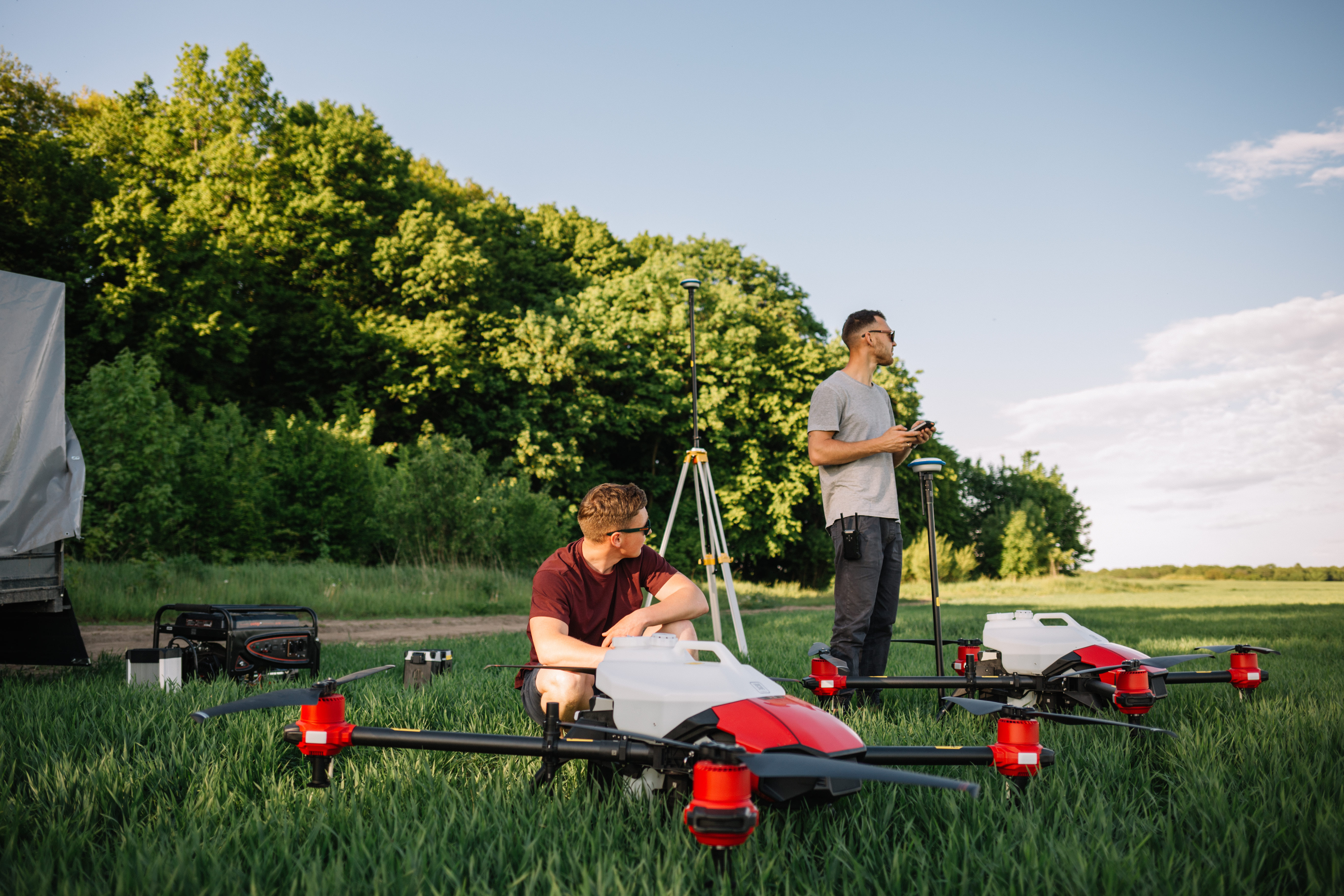
As demand grows, the quality of drone footage becomes a key differentiator. Professional drone filming for agriculture requires more than piloting skills; it demands an understanding of agricultural processes, environmental sensitivities, and regulatory frameworks.
Experienced drone operators plan flights carefully to capture meaningful data while respecting safety and legal requirements. Professional video teams also ensure that footage is stabilised, colour-corrected, and edited to meet both analytical and communication goals. This level of quality is essential when footage is used for scientific analysis, official reporting, or public-facing content.
Partnering with a specialised video production company ensures that agricultural and environmental drone footage delivers maximum value. From initial planning to final delivery, expert teams align technical execution with strategic objectives, creating content that informs, persuades, and performs.
The Future of Agricultural and Environmental Drone Footage
The future of agricultural drone footage lies in deeper integration with data analytics and sustainability strategies. Advances in sensor technology, AI-driven analysis, and real-time monitoring will further expand what drone videography can achieve.
As climate pressures intensify and food systems evolve, the need for accurate, scalable land assessment tools will continue to grow. Drone footage will play an increasingly central role in how organisations understand their environments, manage resources, and communicate impact.
For agricultural companies, researchers, and NGOs, investing in professional drone videography is an investment in clarity, efficiency, and credibility. It enables smarter decisions today while building a visual record that supports long-term sustainability goals.
Conclusion
From farmland to research labs, agricultural drone footage has become a powerful tool for modern land management and environmental science. By combining precision, scale, and visual storytelling, drone videography supports better farming practices, more effective research, and clearer sustainability communication.
For teams seeking to elevate their agricultural or environmental projects, professional drone filming offers a future-ready solution — one that turns data into insight and insight into action.
Discover how professional agricultural and environmental drone filming can support your next project!
FAQ
What is agricultural drone footage used for?
Agricultural drone footage is used for crop monitoring, land assessment, irrigation planning, and yield analysis. By capturing high-resolution aerial visuals, farms and agribusinesses can identify problem areas early, optimise resource use, and make data-driven decisions that improve productivity and sustainability.
How does drone filming support precision farming?
Precision farming drone video provides a full overview of crop conditions across large areas. It helps detect uneven growth, water stress, or pest damage that may not be visible from the ground. This allows farmers to apply targeted treatments rather than blanket solutions, reducing costs and environmental impact.
What is the difference between agricultural and environmental drone videography?
While agricultural drone footage focuses on farming operations and crop performance, environmental drone videography is used to study ecosystems, land use, and environmental change. Environmental drone filming often supports research, conservation projects, and impact assessments for NGOs, researchers, and government bodies.

Leon
Leon is an award-winning videographer and the driving creative force behind Splento’s video production team. With over a decade of experience, he has a deep-rooted passion for visual storytelling — capturing everything from high-impact corporate events to personal, unforgettable moments. Known for his precision, narrative clarity, and keen eye for detail, Leon transforms every brief into a compelling visual story that makes people stop, watch, and remember.